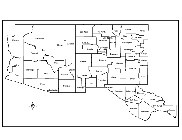
List of Counties Covered by this Manual
Arizona
| Apache | Cochise | Coconino | Gila | Graham |
| Greenlee | La Paz | Maricopa | Mohave | Navajo |
| Pima | Pinal | Santa Cruz | Yavapai | Yuma |
New Mexico
| Bernalillo | Catron | Chaves | Cibola | Colfax |
| Curry | De Baca | Doña Ana | Eddy | Grant |
| Guadalupe | Harding | Hildalgo | Lea | Lincoln |
| Los Alamos | Luna | McKinley | Mora | Otero |
| Quay | Rio Arriba | Roosevelt | San Juan | San Miguel |
| Sandoval | Santa Fe | Sierra | Socorro | Taos |
| Torrance | Union | Valencia |
Trans-Pecos Texas
| Brewster | Culberson | El Paso | Hudspeth | Jeff Davis |
| Pecos | Presidio | Reeves | Terrell | Val Verde |
Map Of Arid Southwest
Map of the Arid Southwest as defined for this website. Map developed by Max Bleiweiss, Department of Entomology, Plant Pathology and Weed Science3, New Mexico State University.
Click on image to view larger